Building the evidence for disaster recovery: How Councils are closing the DRFA gap
Building the evidence for disaster recovery: How Councils are closing the DRFA gap
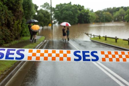
When the ABC reported on 15 September that Buloke Shire was still grappling with flood-damaged roads and stalled recovery funding, it highlighted a problem shared by councils across Australia. The Disaster Recovery Funding Arrangements (DRFA) require detailed “before and after” photographic evidence before funds are released. For many councils, meeting that burden of proof has been almost impossible.
The result? Roads left unsafe long after floods have receded, rising repair costs, and communities waiting years for basic infrastructure to be restored.
Why Roads Bear the Brunt
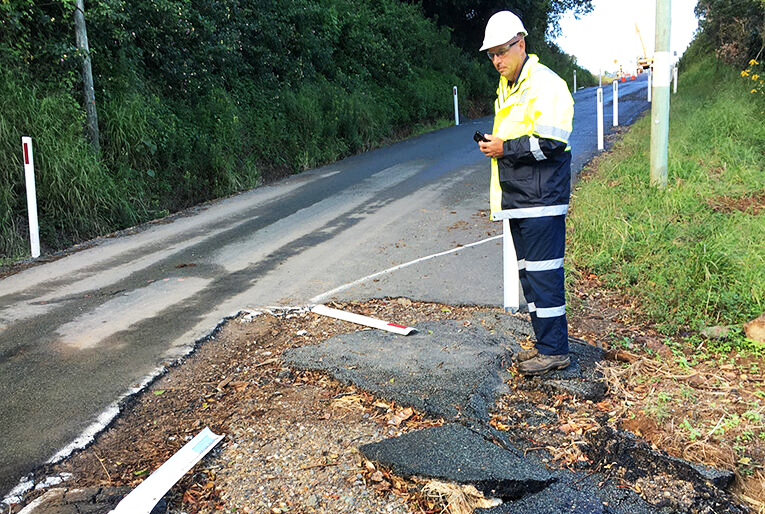
Roads are at the centre of this challenge. They are often the first to be damaged in storms, the most expensive to repair, and the most visible reminder to residents when recovery stalls. For rural councils like Buloke, roads are lifelines: connecting farms to markets, kids to schools, and emergency vehicles to towns.
When those roads remain potholed, undermined, or unsafe, the impact spreads far beyond inconvenience — it touches safety, resilience, and local economies.
Turning Red Tape into Readiness
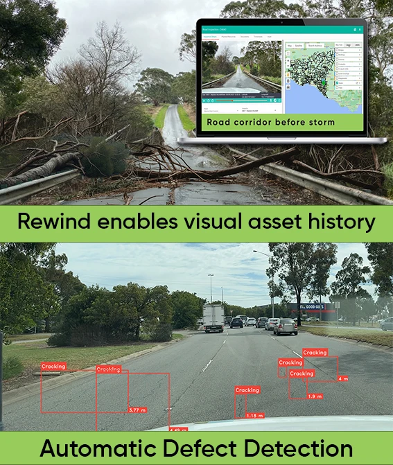
DRFA eligibility often hinges on photos councils simply don’t have. The answer is smarter systems that capture road evidence before disaster strikes.
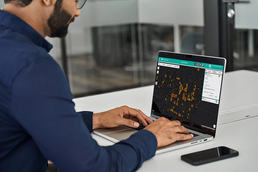
AutoPilot by Asset Vision is one solution changing the way evidence is gathered. Using just an iPhone mounted in inspection vehicles, AutoPilot captures images every 10 metres, automatically geo-tags and timestamps them, and stores them securely in the cloud. Councils can then “rewind” past inspections to see exactly how a road looked weeks or months earlier often before a weather event.
AutoPilot’s AI layer goes further by automatically flagging defects such as potholes, bleeding edges, flushing, cracking, and surface fatigue. That means councils aren’t just storing images, they’re building an intelligent dataset that highlights problems early, strengthens DRFA claims, and supports proactive maintenance.
Instead of scrambling for evidence, councils can now provide funding bodies with an auditable record of road conditions, making claims faster, cheaper, and more reliable.
Buloke joins the change
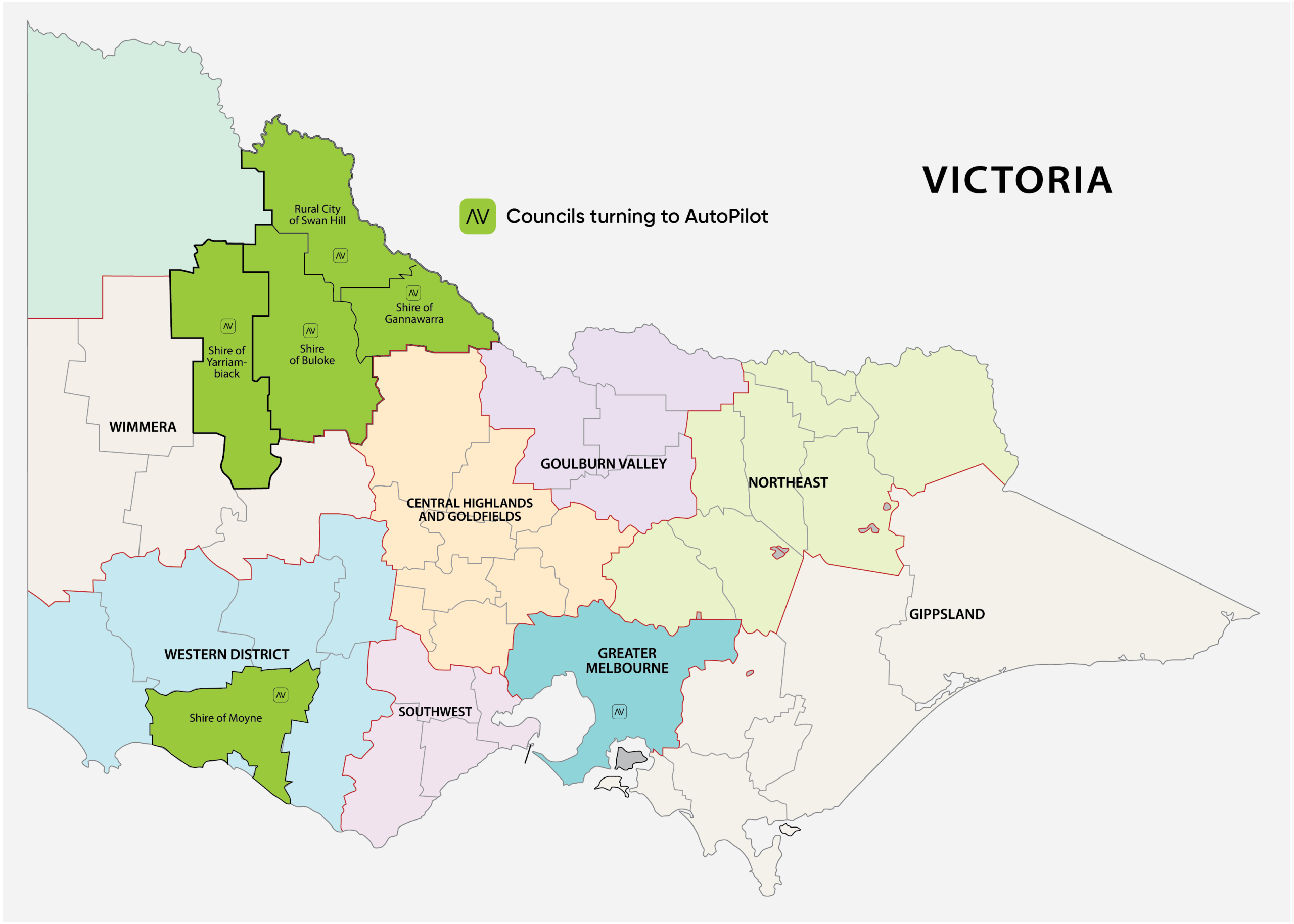
Buloke Shire joined five other councils in adopting Asset Vision, choosing to focus first on its roads. The timing is critical: Buloke is addressing exactly the challenges ABC reported — unsafe roads, delayed funding, and the absence of “before” photos. By embedding AutoPilot into everyday inspections, the council is building the baseline evidence DRFA demands.
And Buloke isn’t doing this in isolation. Neighbouring councils, Swan Hill, Gannawarra and Yarriambiak, have also adopted Asset Vision. Together, these councils are building a regional network of consistent evidence capture, allowing them to benchmark road performance, share insights, and strengthen joint recovery efforts when disasters affect whole regions.
For communities that share borders, services and even recovery resources, this alignment matters. By capturing consistent, rewindable road data, neighbouring councils can learn from one another, benchmark performance, and even support each other with stronger joint claims when disasters affect entire regions.
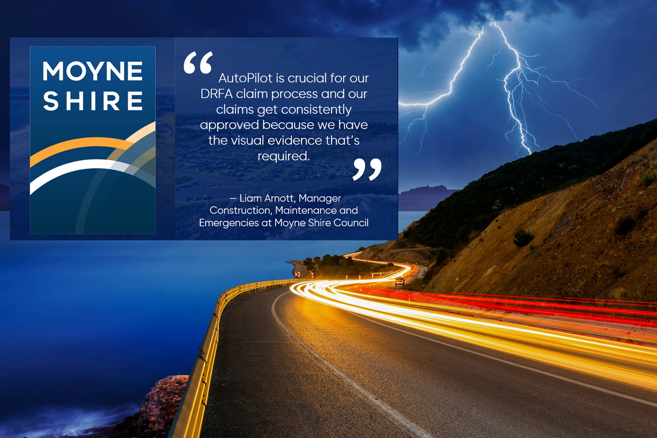
Lessons from Moyne
While Buloke is just starting this journey, Moyne Shire Council has already shown what the payoff looks like. After storms left widespread damage across its network, Moyne was able to rely on AutoPilot’s photographic history to compile claims quickly and with confidence.
As Liam Arnott, Manager Construction, Maintenance and Emergencies at Moyne, explained: “AutoPilot is crucial for our DRFA claim process and our claims get consistently approved because we have the visual evidence that’s required.”
For Moyne, AutoPilot wasn’t just about compliance — it was about getting roads reopened faster, keeping communities safe, and reducing the time residents had to wait for vital connections to be restored.
This work also aligns with insights in Asset Vision’s recent whitepaper, DRFA Claims Made Easy, which sets out how councils can streamline disaster recovery applications by embedding evidence capture into day-to-day asset management. The whitepaper reinforces the same themes raised in the ABC reporting: the funding bottleneck is real, but it can be overcome with better data and stronger systems.
Beyond Disaster Recovery
The ABC story focused on flood recovery, but the benefits of AutoPilot+AI go further. Councils are now using AutoPilot to:
- Identify defect hotspots in the network to prioritise maintenance and capital works programmes
- Defend third party claims
- Customer Service Improvements by enabling quicker triage and more accurate responses to customer enquiries.
- Prioritise renewal programs with confidence.
- Strengthen grant funding applications with indisputable evidence.
By embedding evidence capture into everyday road management, councils aren’t just preparing for the next disaster — they’re making smarter, data-driven decisions for the long term.
A Smarter Future for Councils
The ABC’s reporting showed the cost of inaction: unsafe roads and communities left waiting. The stories of Buloke and Moyne point to a better way forward.
With rewindable road histories in place, councils can submit stronger DRFA claims, secure funding sooner, and restore critical infrastructure faster. Just as importantly, they can use that same evidence base to plan smarter and deliver more resilient outcomes for their communities.
Because in the end, this isn’t just about potholes and paperwork. It’s about trust. Communities trust their councils to keep roads safe. Councils trust governments to support them in times of crisis. And governments need trusted evidence to release funds.
Technology like AutoPilot+AI is helping to bridge that trust gap — one road at a time.
For more information on how Asset Vision can support your council’s asset management needs, visit Asset Vision’s Local Government page.

Asset Vision Co Limited (ASX:ASV)
Head Office:
Melbourne Suite 4,
799 Springvale Rd,
Mulgrave, Victoria,
3170, Australia.
Gold Coast Office:
Ground Floor,
120 Siganto Drive,
Helensvale, 4212,
Australia.
CONTACT DETAILS
Phone: 1800 AV DESK – (1800 283 375)
Gold Coast Office – (0733 870 181)
Email: contact@assetvision.com.au
Terms and Conditions : Privacy Policy : Articles
 –
–