
Capture a digital twin and automatically identify road defects using AI technology.
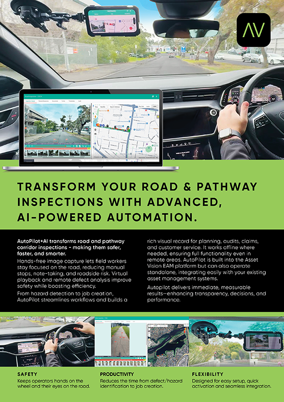
AutoPilot+AI transforms road and pathway corridor inspections – making them safer, faster, and smarter.
Hands-free image capture lets field workers stay focused on the road, reducing manual stops, note-taking, and roadside risk. Virtual playback and remote defect analysis improve safety while boosting efficiency.
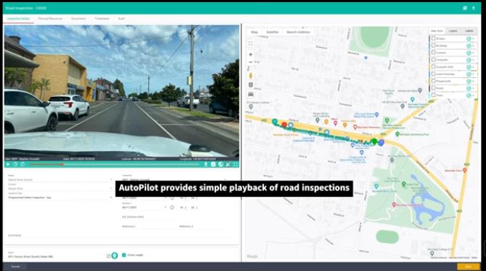
AutoPilot enables the Asset Vision mobile app to automatically and silently capture photos of the oncoming road every 10 metres during an inspection.
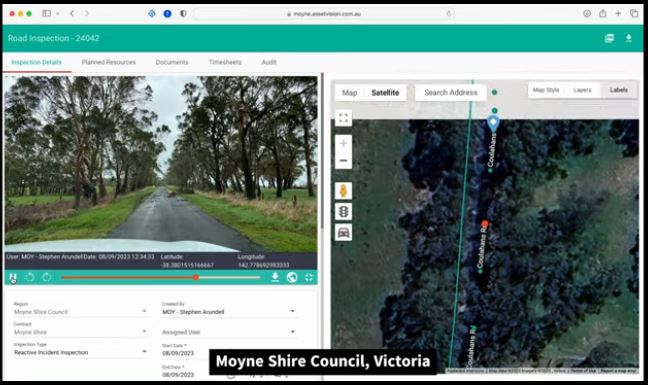
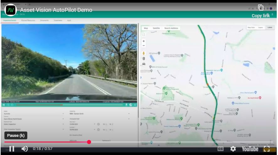
These photos are uploaded to the cloud and stored against the inspection for sequential playback through the Asset Vision web portal, with the location of where the photo was taken moving along the map in real time, along with any detected road defects.
Users can review the inspection, extract images, including metadata with relation to date/time captured and GPS coordinates, as well as create follow up work activities for defects and/or areas of interest.
Autopilot captures a digital Twin and automatically identifies road corridor defects using AI technology
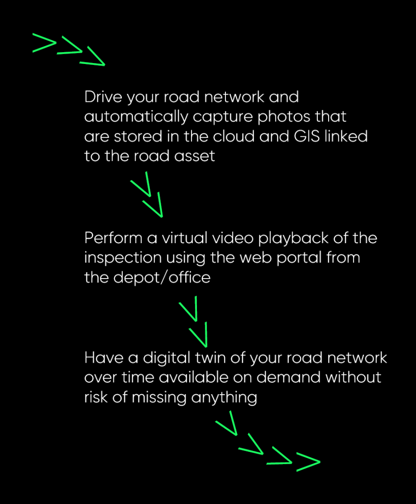
AutoPilot uses AI to identify road defects
AutoPilot helps users quickly identify areas of interest by analysing each captured image for potential defects, such as cracking and potholes. These locations are highlighted automatically and presented for easy navigation and review during playback.
AutoPilot transforms every inspection into a consistent source of evidence by applying AI to each image. Potential defects are identified, measured and organised automatically, giving teams clarity on where attention is needed. This reduces review time, improves safety, and ensures decisions are supported by objective, repeatable data.
For a deeper technical overview, the AutoPilot Technical Catalogue outlines how the system works, its specifications, supported devices and available accessories.
Safety
AutoPilot improves safety by eliminating the need for manual defect logging during inspections. The system captures imagery automatically at consistent intervals, reducing driver distraction and removing the requirement to handle devices while on the road. Field teams can focus entirely on driving, especially on high-speed corridors, bridges and narrow roads where stopping is unsafe or impossible.
Productivity
AutoPilot dramatically increases inspection efficiency by capturing thousands of high-quality road images automatically, without any user interaction. Every photo is GPS-tagged and linked to inspection routes, allowing AI to detect potential defects and fast-track DRFA assessment, validation, and verification. Councils gain a complete visual dataset in a fraction of the time.
Flexibility
AutoPilot runs seamlessly with Asset Vision or alongside your existing systems. Whether you use it for routine inspections, DRFA evidence capture, contractor audits, or post-event assessments, AutoPilot adapts to your workflows. Start with basic automated photo capture, then enable AI defect detection when you’re ready – it scales with your program.
Example videos
Our Clients


talk to us
We’re with you through the ups and downs of asset management. Contact us today to find out more and fill out your details to request a demonstration on our platform.