

From damage to defensible evidence: How councils can strengthen DRFA recovery
After a flood, storm or bushfire, council teams can often see what needs repairing within hours. Proving what happened, what was damaged and which costs are eligible can take much longer.
Under the Disaster Recovery Funding Arrangements (DRFA), a damaged road, culvert or stormwater asset is only the beginning. A council needs to connect the asset’s pre-event condition with the damage caused, the work delivered and the costs incurred.
When those records sit across different systems, folders and spreadsheets, recovery teams are forced to reconstruct the story under pressure. Faster DRFA recovery is therefore not only a claims challenge. It is an asset information challenge.
A strong evidence chain connects:
Asset → location → pre-event condition → post-event damage → scope → work delivered → actual cost → completion evidence
Technology cannot make an ineligible activity eligible. It can, however, stop valid evidence being lost between the roadside, works depot, contractor, asset team and finance ledger.
Readiness starts before the event
The strongest post-event evidence is often created through routine work undertaken months or years earlier.
Current asset registers, maintenance histories, inspections and geospatial imagery provide the baseline needed to identify new damage. In Queensland, the Queensland Reconstruction Authority’s photo evidence guidance says local-government visual evidence of pre-disaster condition should be the latest available and no more than four years old. Images should retain GPS, date and time metadata and be supported by accurate asset and maintenance records.
QRA also urges councils to check their Digital Road Network data before each disaster season and ensure the same road and chainage dataset is used by the council, QRA and any third-party capture provider.
Routine inspections are therefore more than maintenance records. They are part of a council’s recovery readiness.
Capture the network quickly, then investigate where needed
After an event, regional councils may need to assess hundreds or thousands of kilometres of road while access is constrained and staff are responding to urgent community needs.
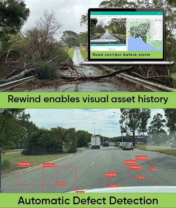
Asset Vision AutoPilot captures forward-facing images approximately every 10 metres during an inspection drive. Each image is linked to its GPS location and capture time, then organised for sequential playback against a map.
Teams can review affected areas from the office, compare current and historical imagery, extract evidence and create follow-up work. AI-assisted analysis can flag potential defects such as potholes and cracking, helping reviewers move more quickly to locations requiring closer assessment.
AI detection remains a triage tool, not a DRFA eligibility decision. Engineers, inspectors and recovery specialists still confirm event damage, scope and quantities. Network imagery may also need to be supplemented with close-ups, measurements and sequential photographs. Broad corridor capture provides speed; targeted inspection provides the evidentiary detail.
Queensland’s updated labour-cost requirements extend the evidence chain
The evidence burden does not stop with damage imagery.
The National Emergency Management Agency’s DRFA Labour Costs National Guidance Note, published in March 2026, applies to relevant costs incurred from 1 July 2025. Labour costs must be linked to an eligible event and measure, supported by records such as timesheets, activity logs, tasking statements and progress reports. Payroll oncost calculations must also be reviewed annually and supported by source documentation.
In Queensland, QRA sought to have updated council payroll oncost calculations implemented by 1 September 2026. If a council failed to respond by that date, QRA advised that it would determine a rate from publicly available information and apply that rate to submissions processed after 1 September 2026.
The national guidance also identifies the administrative work involved in preparing, reviewing or assuring DRFA claims as ineligible expenditure. Reducing manual collation therefore protects council capacity as well as time.
This makes field-to-finance traceability increasingly important. Inspections, jobs, labour, contractors, direct costs and completion records need to remain connected to the relevant asset, event and funding measure. Where enterprise and finance systems are integrated, common identifiers can help reconcile delivery records with actual costs in the council ledger.
AI Assistants can help find gaps
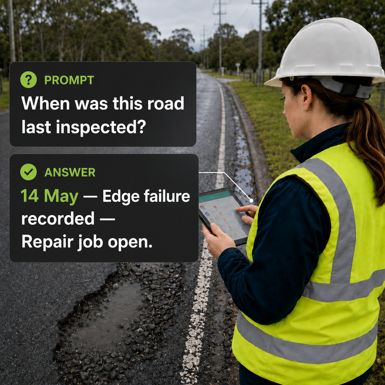
Once recovery information is structured, natural-language AI can help authorised users find and understand it faster.
Asset Vision connects with Microsoft 365 Copilot, ChatGPT and Claude. Depending on the information captured and the organisation’s configuration, recovery teams could ask:
- Which roads inspected after this event have potential defects but no follow-up assessment?
- Which emergency works jobs are missing completion images or a linked asset?
- Summarise open recovery work by location, status and priority.
- Show the inspection and works history for this damaged road section.
AI cannot create evidence that was never captured or determine whether expenditure is eligible. Its value is in helping users query records, prepare summaries and identify possible gaps. Access remains governed by the organisation’s existing Asset Vision permissions and controls.
Moyne Shire: evidence built through everyday work
Moyne Shire Council manages more than 2,700 kilometres of roads across a region regularly affected by storms, flooding and road blockages.
The council uses Asset Vision to undertake inspections, view its network in the field, record work and generate reports. AutoPilot adds a visual history that can be revisited when disaster damage needs to be assessed and evidenced.
As Liam Arnott, Manager Construction, Maintenance and Emergencies at Moyne Shire Council, explains:
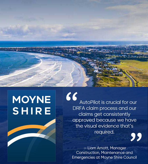
“AutoPilot is crucial for our DRFA claim process and our claims get consistently approved because we have the visual evidence that’s required.”
The lesson is not that technology guarantees approval. It is that evidence captured consistently through everyday operations is far more useful than evidence assembled retrospectively under pressure.
Five actions before the next disaster season
- Check core asset data. Confirm asset IDs, names, ownership, locations, road geometry and chainage.
- Build a current visual baseline. Schedule regular corridor capture and targeted condition inspections, retaining location and time metadata.
- Keep evidence connected. Link event damage, inspections, scope, jobs, photos, progress and completion records to the same asset and event.
- Close the field-to-finance gap. Align event and project identifiers across timesheets, contractors, invoices, direct costs and ledger entries.
- Test retrieval before it matters. Confirm the team can assemble the evidence for one damaged asset and identify missing records quickly.
Councils should test their process with recovery advisers, finance teams and the relevant state or territory authority, not only with the asset team.
Recovery speed starts with everyday work
The speed of a DRFA submission is not decided when someone begins completing the form. It is shaped beforehand through the quality of the asset register, inspections, imagery, work history and system integrations.
When that foundation is in place, AutoPilot can scale field capture, Asset Vision can connect evidence with work delivery, and AI connectors can help authorised teams reach the right information sooner.
Technology cannot remove every complexity or guarantee an outcome. It can reduce avoidable uncertainty, duplication and manual effort when councils and their communities can least afford it.
Ready to strengthen your council’s DRFA evidence chain?
With rewindable road histories in place, councils can assemble stronger submissions, reduce avoidable delays and support faster restoration of critical infrastructure. Just as importantly, they can use that same evidence base to plan smarter and deliver more resilient outcomes for their communities.
Explore Asset Vision AutoPilot, learn more about AI-powered Asset Intelligence or talk to our local government team.
This article provides general information only. Requirements vary by jurisdiction, event and funding measure. Councils should refer to current NEMA and state or territory guidance. Queensland references were current at 15 September 2026. This information does not constitute legal or funding advice.

Frequently asked questions
What are the Disaster Recovery Funding Arrangements?
The Disaster Recovery Funding Arrangements, or DRFA, are jointly funded by the Australian and state or territory governments. They provide financial assistance following eligible disasters, including support for emergency works and restoring damaged essential public assets. Applications are administered by the relevant state or territory authority.
What evidence may be required for a DRFA submission?
Requirements vary by jurisdiction and funding measure, but councils may need to demonstrate the asset’s location and pre-disaster condition, the nature and extent of event damage, the work required and completed, and the actual costs incurred. Photographs, inspection records, asset data, work histories, timesheets, invoices and completion evidence may all contribute to the evidence chain.
What changed for Queensland council payroll oncosts in 2026?
In Queensland, QRA sought to have updated council payroll oncost calculations implemented by 1 September 2026. If a council failed to respond by that date, QRA advised that it would determine a rate from publicly available information and apply that rate to submissions processed after 1 September 2026.
How can AutoPilot support DRFA evidence collection?
AutoPilot captures geolocated and time-stamped road imagery approximately every 10 metres during an inspection drive. Teams can review routes remotely, compare historical and post-event imagery, extract relevant evidence and create follow-up work. AI-assisted detection can also highlight potential defects for review. Detailed site photographs and measurements may still be required.
Does AutoPilot guarantee that a DRFA submission will be approved?
No. Eligibility and approval remain the responsibility of the relevant recovery authority. AutoPilot helps councils collect, organise and retrieve stronger visual evidence, but it does not determine whether an asset, activity or cost is eligible for funding.
How can AI connectors assist during disaster recovery?
Asset Vision connects with Microsoft 365 Copilot, ChatGPT and Claude, allowing authorised users to ask questions about inspections, jobs, defects, assets and works history. Teams can use natural-language queries to prepare summaries and identify potential evidence gaps. AI cannot create missing evidence or make eligibility decisions, and access remains governed by existing organisational permissions.
How current should pre-disaster evidence be in Queensland?
QRA guidance states that local-government visual evidence should be the latest available and no more than four years old. Images should retain GPS coordinates, capture dates and times. Accurate asset registers, maintenance records and Digital Road Network data can provide additional context.
When should councils start preparing for a potential DRFA submission?
Preparation should begin before the next disaster. Councils can strengthen readiness by maintaining accurate asset and road-network data, establishing current visual baselines, connecting field activity with work and finance records, and testing how quickly evidence can be retrieved for a damaged asset.